#NatureWritingChallenge - Favorite Morning on Public Lands
“Your Favorite Morning on Public Lands”
Season 2, Week 1
September 13, 2018
Join us on Twitter with the hashtag #NatureWritingChallenge to discuss and share the topic Thursday at 8:30 CST. This post was created in one hour specifically for this challenge.
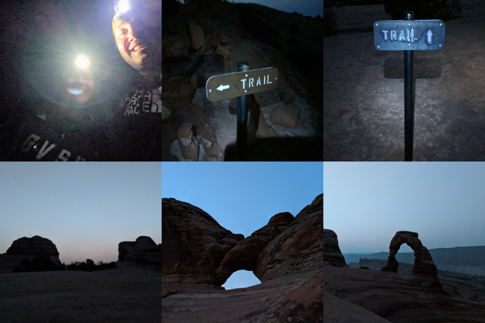
I have a number of memorable mornings on public lands, but nothing quite like the morning I experienced a few weeks ago at Arches National Park. I’ve referenced the hike to Delicate Arch in my Hike 28 post, but I plan to visit why this was so magical for me and my range of feelings before, during, and after.
It was mid-August in Utah so we were expecting warm temperatures and moderate to heavy crowds in Arches National Park the weekend we were there. Our plan was to see as much of the park as we could in the day and a half we had, as well as what we could see at Canyonlands or the surrounding areas. I pitched the idea of starting a hike in the dark, very early in the morning, to Delicate Arch and my best friend Molly was totally on board because she’s just that kind of friend. I hadn’t hiked to Delicate Arch since 2010, and I didn’t really remember much from the hike except there was a ledge and then you were at the arch. Oh, I do remember Delicate Arch being much bigger in person, which shouldn’t be a surprise but was for me again on this visit.
A quick back track… We arrived via plane in Salt Lake City on Friday afternoon, from our home cities, and drove down to Moab Friday evening. We ate and drank at the Moab Brewery and then found our Airbnb just outside of town. Our plan was to wake up at 4, head to the Delicate Arch trail and hike up for the sunrise. We entered Arches about 4:15 AM Saturday and noticed some rain. The rain seemed to get more intense as we drove through, but we parked at the trailhead anyway and waited until about 5 AM. There were a few other people waiting it out, and eventually the rain let up as the light started to increase. People from a car that had came in and parked next to us headed out on the trail. We were not feeling as ambitious, as the sky wasn’t clear and we didn’t really want to end up wet for the whole day, so we headed back towards the entrance. The radar came up as cell data returned and we felt the right choice as the rain showers weren’t done for the immediate future. We had breakfast at the Moab Diner and decided to just enjoy the park all day and try again the next morning.
Sunday morning came and we were determined to make this happen. The weather was dry, the air was mild, and the parking lot was mostly empty. We were excited, this was happening! We strapped our headlamps on and ensured we had what we needed in my backpack, and hit the trail. I had downloaded the topographic map to my phone as well as had a screenshot of it, per the advice of Jenny the Trailhead. Luckily, thankfully, we didn’t really need the map. Since 2010, they had installed signs (though, if they were there in 2010 they were not in my pictures or memory) the whole way up. I had mixed feelings about the signs, still do, but they were helpful and steered us in the right direction when I was accidentally steering us in the wrong direction. I have a lot to learn about maps and directions, despite having a love for maps and directions.
The first portion of the journey was a well manicured, well built hiking trail that took us up a series of switchbacks to the open rock face that we’d continue onward and upward next. Being out there, under the stars in the early morning was pure bliss. Hiking in the dark was a new and exciting treat for both of us and something I want to incorporate into my rotation more often. Having an “unknown” factor due to limited sight and not remember the trail from eight years ago really heightened any excitement level.
As we scrambled over the (what I assumed) to be red rocks, we made it to the next portion on the journey and it was a little confusing for a second. The area, though mostly level, dipped through a low area and then quickly turned right to ascend towards Delicate Arch. I got confused and led us a bit off course but Molly corrected us and got us back on track. The morning light was getting brighter and we had reached the point where headlamps were not necessary any more. The excitement of the darkness was gone and replaced with the excitement of being nearly there. I was sweating buckets at this point, but it was worth it so far.
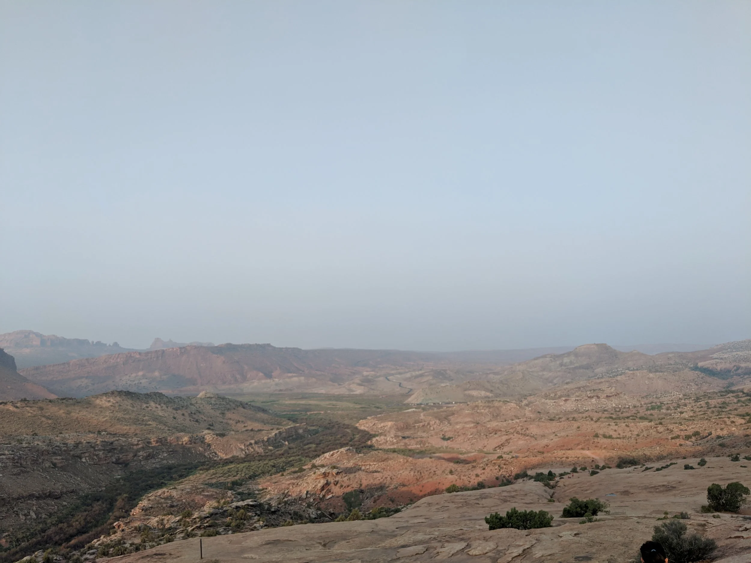
The final dash was an incline along a rock wall, essentially a ledge, that ended with our first view of Delicate Arch. The ledge was probably the easiest part, for me, and one of my favorites because I thoroughly enjoy walking on the edge of something. My heart was racing, my shirt was sweaty, and my mind was thrilled at the ledge and first sight of the arch ahead. We were one of the first few groups up there, second or third, and had our choice of spots to watch the sun rise in the distance. The sky was hazy, from what I assume was wildfire smoke out west, and the sunrise was quite unique because of that. More people made their way up, but it never felt too crowded. Some people may have lingered too long in front of the Arch or made dangerous choices, but everything seemed fine overall. When we got up to relocate, away from the main “entrance” for hikers, I fell. For a moment I thought I was going to die. It was a cartoon style fall, feet out from under me, nearly kicking Molly in the head, and I blacked out for just a second as my back hit the ground. My head was safe, and I had fallen into an area that wouldn’t have allowed for rolling off the cliff. I was embarrassed, but okay, and off we went to get a better seat and a closer look.
This whole morning had been a dream, and we had just started our day. After the sun was up and the people count multiplied exponentially, we decided to head down. Seeing the trail for the first time in real light was weird and wonderful. The views we missed and the little sights along the way were impressive and spectacular. Seeing your path and footing really helped as we descended the rock face, which was pinkish red, and getting to the car as the parking lot was filling up made us feel victorious in a way. We conquered this trail, had this experience, and it was only breakfast time for most. At the parking lot, we passed people who noticed Molly’s Western Michigan University shirt. We stopped to chat and learned they were also from Michigan and about to hike up to the arch. We recalled our experience, gave some pointers, and made sure they had water.
I left Arches feeling accomplished and inspired. I knew I could do the hike, but actually doing it and experiencing it made all the difference. Hiking under the stars and seeing that first light in an amazing setting was phenomenal and something I’ll never forget. If you’re going to Delicate Arch, I highly suggest doing it in the morning to avoid the head and avoid the crowds. People are fine, it’s expected, but why not see it before they arrive if you have the ability and time? One final thing… if you go up to Delicate Arch, OR ANYWHERE ON PUBLIC LANDS, leave no trace. Pack out your trash - this includes orange peels and sunflower seed shells. There were SO MANY seed shells up at the Arch. For more information on how to enjoy nature without destroying it, visit the Leave No Trace (LNT) website.
#NatureWritingChallenge - I Didn't Even Know the Desert Could Do This!
Topic: A day of surprising wildflowers on America's Public Lands
As with every #NatureWritingChallenge, this post was created, edited, and uploaded within an hour.
Who knew the desert could bloom, and why didn't you tell me!?
It was 2008 and my two great friends and I were on a road trip to see the west. I've talked about these road trips in numerous blog posts, but they're an important part of my love for public lands and road trips. We had taken a trip in 2007 and stopped at a few cool places, but wanted more out of this year so we planned some major stops. We started in the Pacific Northwest and made our way down the coast through the Redwoods and over to Sequoia/Kings Canyon and on to Death Valley.
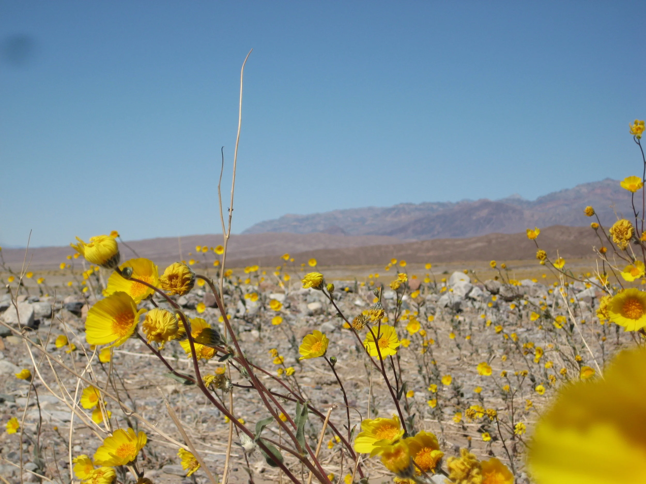
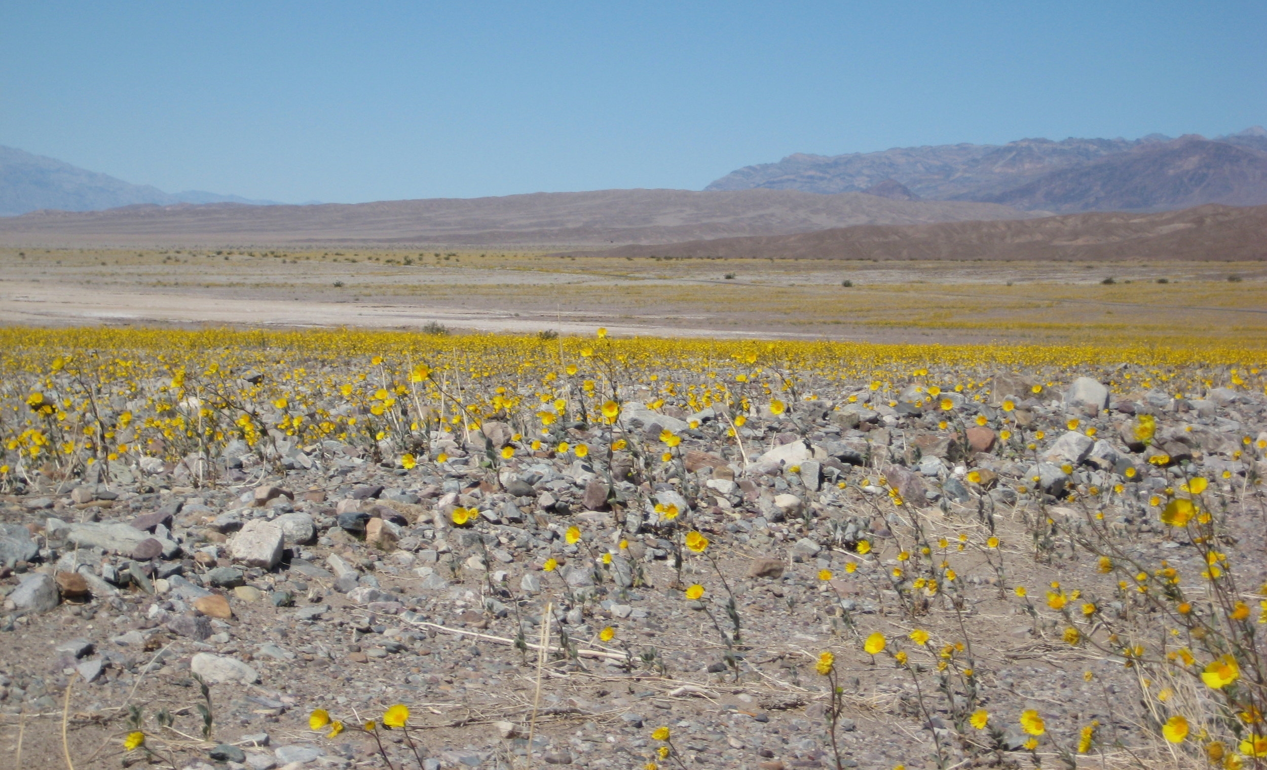
None of us had been to Death Valley, nor the other places on the list, so this was a first-time experience for us all. We entered the park, with views of mountains and started descending. The views on the way in were as if we had been transported to another planet. It went from giant trees to desert with snow capped mountains in the background so quickly. We stopped early on to take some photos and so my friend could check out the dirt - he was a geology major and is now a geologist. From there we went down to sea level, and of course stopped for a picture. From there we kept going down, with plans to stop at the historical sites along the way to Badwater Basin. As we stopped to take it all in, we realized we were in the midst of a desert bloom (or whatever we called it in 2008).
In my current state of being, I know what a desert bloom is. I see all of the photos from the California desert and high desert areas in other states all spring long. Back then, before even researching a road trip destination too much, I had absolutely NO IDEA what a desert bloom was or that it could even happen at this level. We had stumbled upon, what I now realize, a brief window in time when people plan for and take vacation time to see what Mother Nature can do with colors in the desert. It was gorgeous! Yellow flowers across the desert, with snow capped mountains in the background. Simply amazing and unexpected. I look back at the photos, trying to remember what I was thinking and can only imagine it wasn't much. I'm not sure in 2008 we appreciated it as I would today, but I know it caught our eye and offered a nice experience nonetheless. I can't say the photos we took in 2008 do it any justice, but it was very windy and we didn't quite try too hard.
Nowadays, I look forward to the time I'll be able to make a trip to the desert when the flowers are blooming and hope to do it soon. Enjoy these photos from the surprising and unexpected desert bloom of 2008 in Death Valley National Park. May you find some flowers this spring, wherever you are!
#NatureWritingChallenge - A big day in Big Bend
Topic: One last look back at a favorite winter's moment on America's Public Lands
Location: Big Bend National Park - Texas
Date: January 2014
One of the great things about living in Texas can be the lack of a traditional winter with the snow and ice of the north or mountains. I grew up in Michigan, with lake effect blizzards, winter snow, and plenty of cold weather. While I miss the snow, I have mostly adjusted to the mild winters I now enjoy in Texas - it can be the best time of year to be outside.
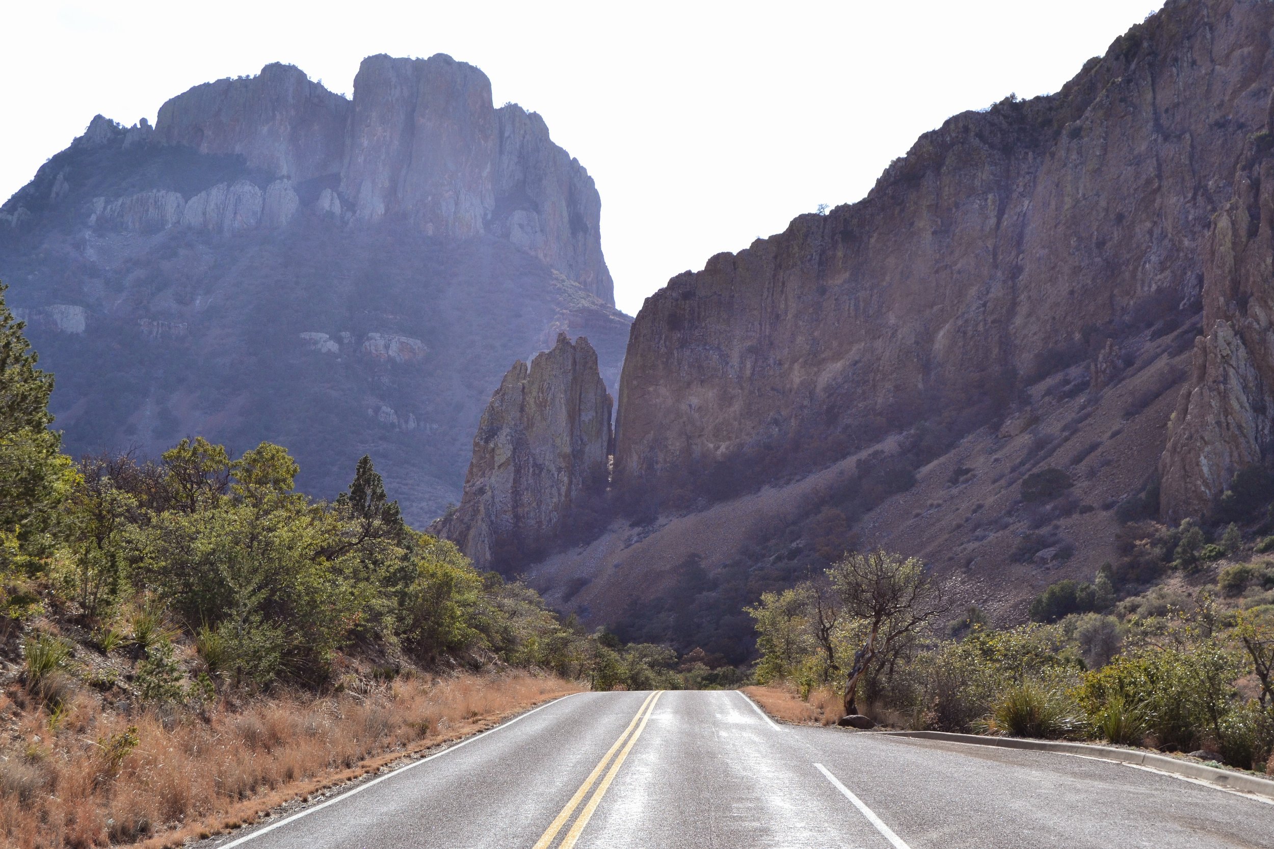
Back in 2014, my other half and one of our best friends embarked on a quick trip to Big Bend National Park. The drive from where we lived at the time was about 8 hours and that is through some of the flattest, most boring parts of Texas that exist. We left our house early, in the dark, with temperatures hovering near 20 degree and arrived to the park with sunshine and slightly warmer air. It was perfect. Sunshine, amazing views along the drive in, and only a few people in the campground - we were off to a good start.
We did a little hike of the Lost Mine Trail and then went to finish setting up camp. We pitched the tent, made some food, watched the sky turn pink, and waited for our friend to arrive - she had to work a half day. It was dark by the time she came, but it was really just in time to see the stars. The night sky was insane! There were more stars in sight than I ever though I'd be able to see. We enjoyed staring up, quietly and drifted off to sleep.
As morning light broke, we learned we had visitors. As we peeked out of the tent, we saw deer in every direction eating the grass at the campsites. Once people began to stir, the deer moved to less populated areas and empty campsites but were undeterred overall. We made breakfast and prepared for the day of adventure. We needed to see most of the park in one day, as we had to leave the next morning. The park is huge, and knowing what I do now, I realize trying to see the whole place in one day is a bit silly. We were blissfully unaware of how long it would take and had no real idea of what was out there to explore. We followed signs, took scenic turnouts, and it seemed to work out well. We saw a variety of landscapes and learned about the history of the park, which was the best we could do looking back.
A highlight of the long day was getting to Santa Elana Canyon in time to see the sun setting on the Rio Grande. We'd walked along the Rio Grande in the Rio Grande Village area but seeing the views from the Santa Elena Canyon Overlook trail was spectacular. Our day of driving went from one end of the park to the other, effectively using every minute of daylight available. We returned to camp in the dark, tired, and ready for bed.
The trip was quick and left us wanting more. I learned about the desert and was able to see how diverse the landscape of Texas can be - in one single park.
**This post was created in 1-hour fro the Nature Writing Challenge on Twitter.
#NatureWritingChallenge - Badwater Basin: 282 Feet Below Sea Level
"A memorable sign on Public Lands" - This post was created for the #naturewritingchallenge in one hour.
I was thinking back to all the signs on public lands - there have been a lot and I'm kind of obsessed with documenting my travels with them. I started to look through my archives, trying to find that most memorable sign. Then, I thought, maybe it's not a photo of a sign but maybe one of those many epiphanies I've had in my life. I've had many moments on Public Lands that have brought great clarity to my brain, but not really any major signs in life. So, I'm going to stick to the physical and share one of my most memorable and favorite signs. The year was 2008, my two good buddies and I had just visited the Redwoods and were moving on through California to Death Valley National Park. I had researched the Redwoods, as mentioned in the post from last week, but I really knew NOTHING about Death Valley prior to visiting. We arrived midday, sun shining, wind blasting, and the desert blooming. We were in shock, coming from moss covered redwoods to giant sequoias to the desert - the hottest, lowest place in the USA.
I can remember the start of our drive through the park - we were truly obsessed with the signs because we were in love with the road trip. Signs were the way we navigated - old school, before smartphones and navigation systems in the dash. We were in our rented car, driving through the desert and we see the sign to turn right in a mile for Death Valley. Eventually, we get to to the Death Valley welcome sign and enter the park, feeling accomplished. We were using Microsoft Streets and Trips, but signs were our guiding visual element. If I went out there right now and reenacted this scenario, with my Google Maps built in to my device, I'm not sure I'd have been as observant of the signs and markers. As I write this I'm having an "ah-ah" moment about how I've become so much less observant in current times and maybe I need to slow it down when I'm out and about. I still notice signs, but I don't obsess over them the way we did before Google Maps and that fresh road trip spirit of the late 2000s.
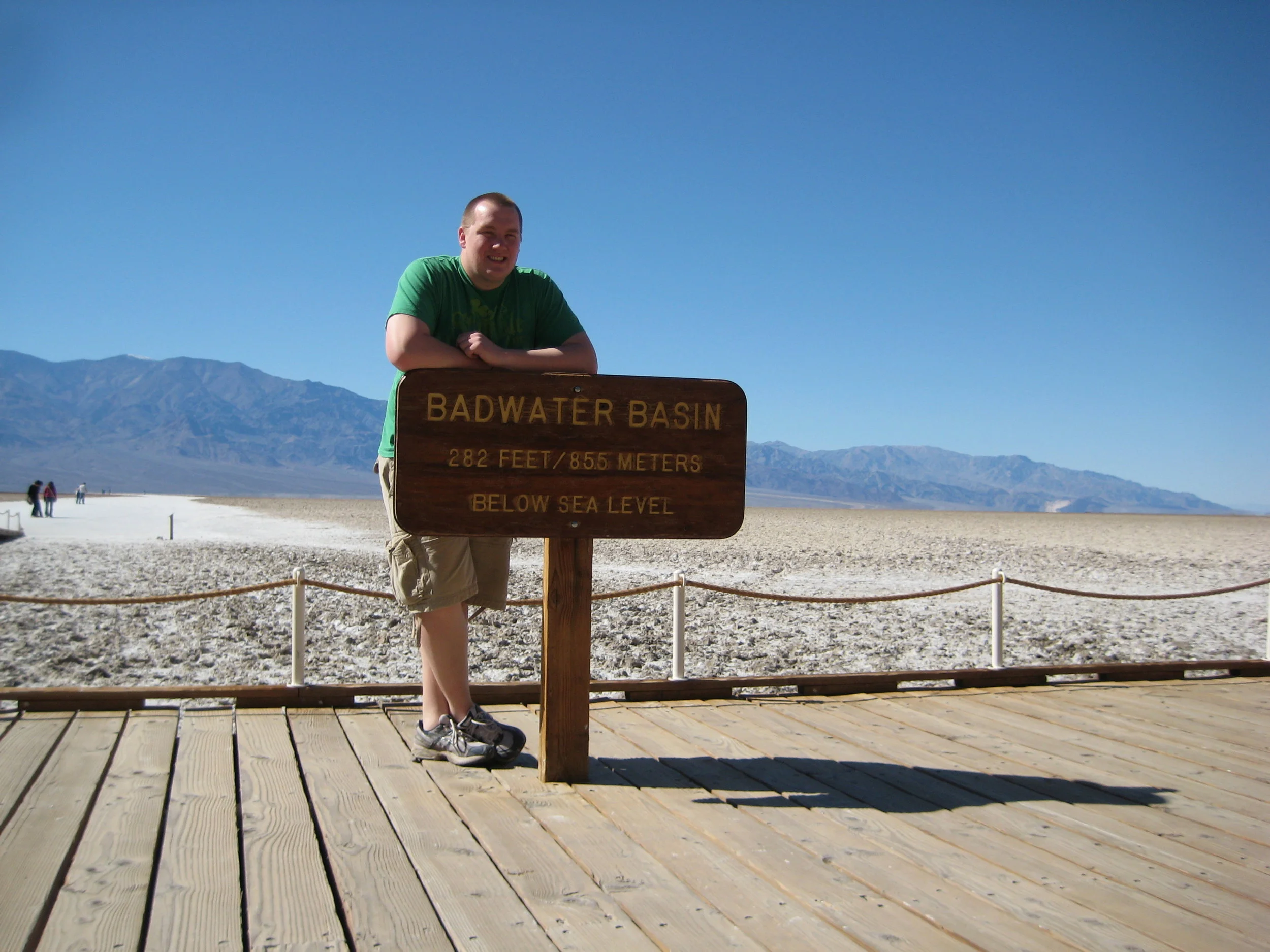
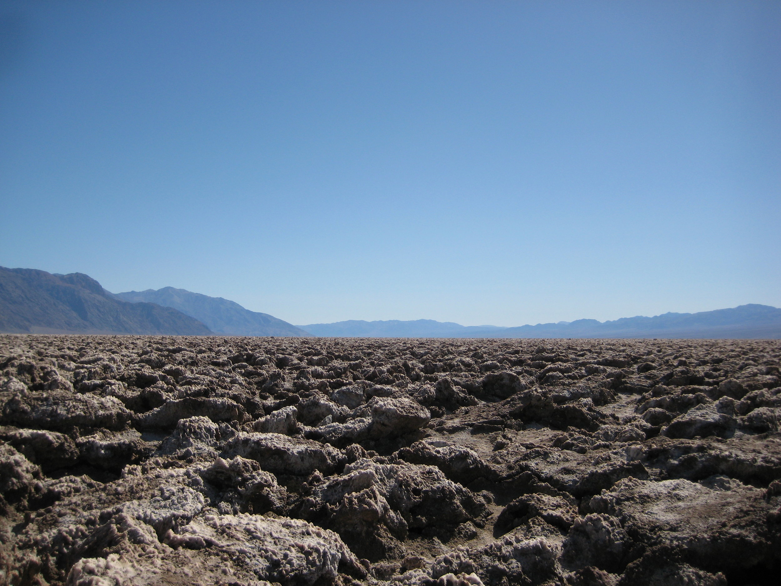
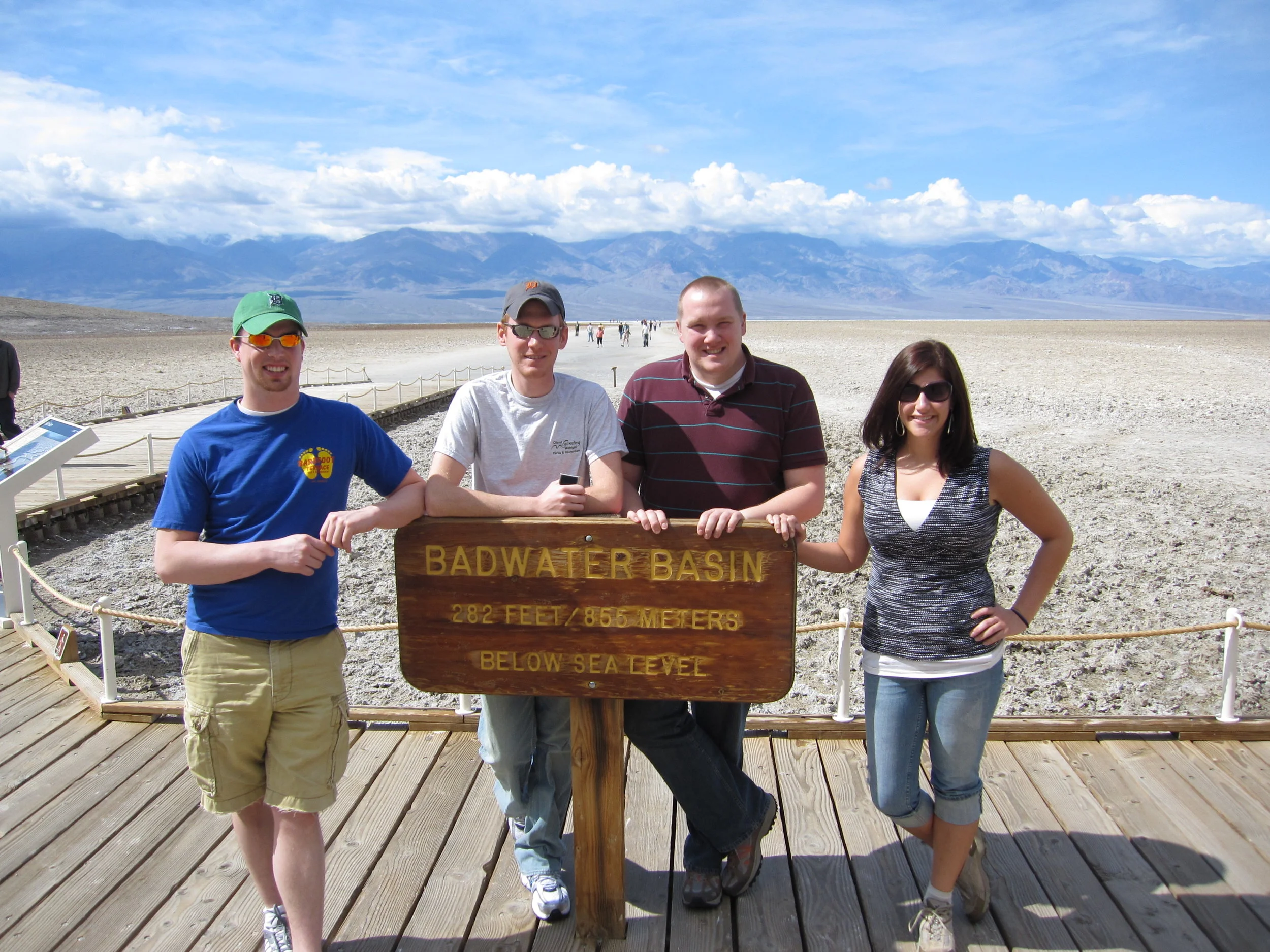
As we meandered through the park, we stopped at various tourist stops to take it in and take pictures. We stopped to take a photo of the sign proclaiming we were at sea level and moved on to see the how borax was mined and transformed and then on to see the desert in bloom. We made our way to the Devil’s Golf Course, to the Furnace Creek Visitors Center, and then to Badwater Basin. When I think of my first trip to Death Valley, I think of Badwater Basin and posing with the sign that says I was 282 feet below sea level. Of all the places we saw, other than maybe the desert in bloom which only seems significant now that I know people flock to see it, Badwater stands out. The white salt flats, the salty pools of water, the view through the valley, and the sign that said I was there. Death Valley and Redwoods were the first two big parks I experienced in my life - and they were a day a part. Sure the trees are unforgettable, in fact I daydream about them often, but being in the hottest and lowest place in the USA is also quite memorable and I have a photo with a sign to prove it.
Two years after this visit, I was able to get back. This time, I knew a little about what to expect when visiting Death Valley. We entered from the east this time, made our way to places I didn't even know existed the first time, I didn't see any bloom in the desert, and I sure did go back to Badwater and stand next to that sign again. Going back, I was genuinely excited to see this place again and to take a photo in front of the sign. Sure, I got to see the valley from Dante's View, hike through one of the side canyons, and see the painted desert hills of the Artist's Drive, but that sign at Badwater was a constant and will be any time I visit in the future. Signs come and go, they change, and they can be metaphorical. Maybe this one sign is just a physical sign, but it's representative of my first desert adventure, inspired me to check out more desert destinations, and beckons me to return to see it and the ever changing Badwater Basin.
The #NatureWritingChallenge is simple: A topic is tweeted and participants have an hour to create, edit, and post an essay. It's designed to create spontaneous, real, and raw content. Douglas Scott from The Outdoor Society started this challenge and all relevant info can be found using the twitter hashtag #NatureWritingChallenge


